A SCIENTIFIC WEBINAR ON COMPUTATIONAL TECHNOLOGIES IN GEOLOGY AND GEOPHYSICS WAS HELD AT THE NATIONAL ENGINEERING ACADEMY OF THE REPUBLIC OF KAZAKHSTAN
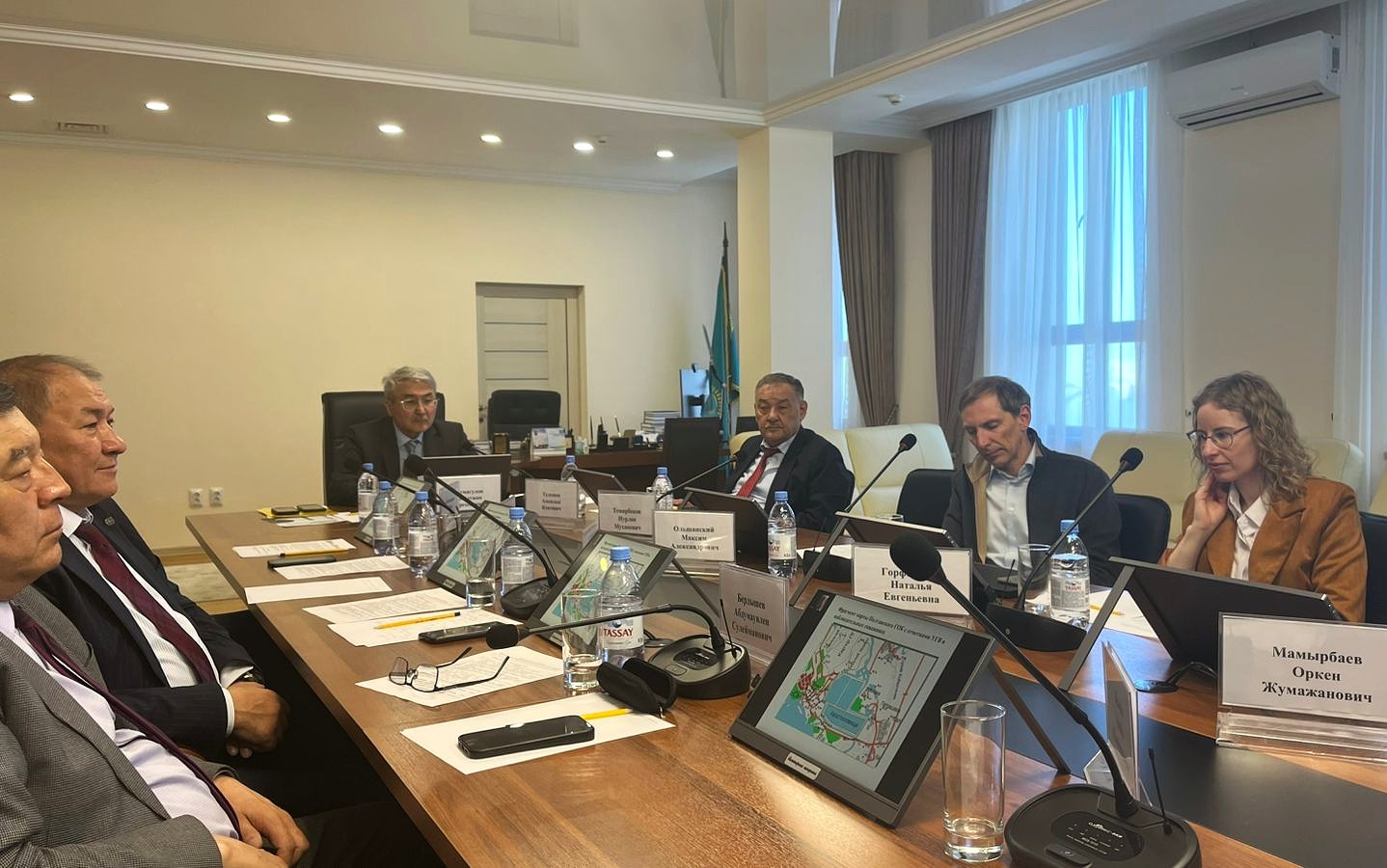
On April 4, 2025, the National Engineering Academy of the Republic of Kazakhstan (NEA RK) hosted a scientific webinar entitled “Computational Information Technologies in Geology and Geophysics”. The event was held in a hybrid format, both onsite and online. The webinar brought together leading scientists and specialists from Kazakhstan, Ukraine, and the USA who are actively engaged in the digitalization of geological and geophysical research.
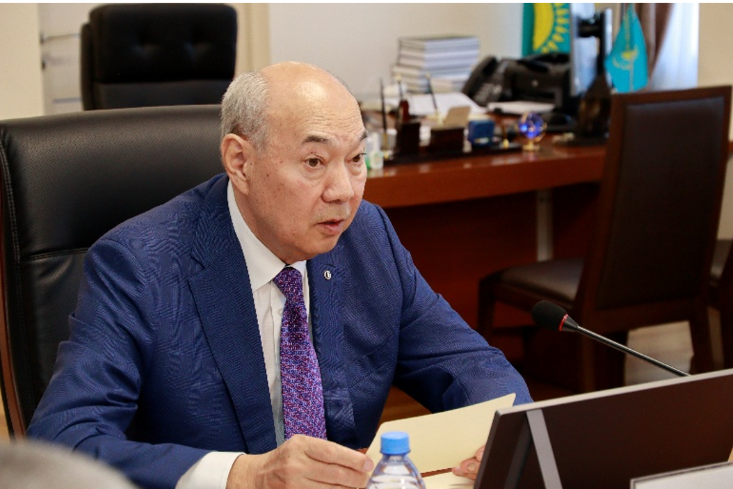
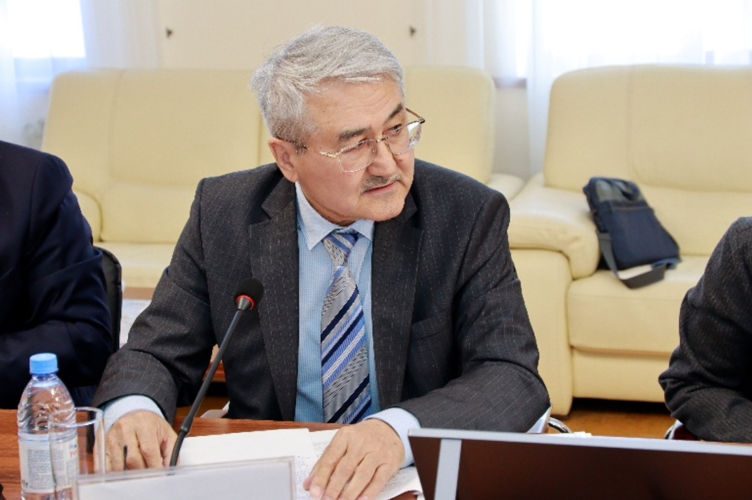
The webinar was moderated by the President of NEA RK, Academician B.T. Zhumagulov, and Doctor of Physical and Mathematical Sciences, Professor, Academician of NEA RK N.M. Temirbekov.
The opening remarks were delivered by the President of NEA RK, Academician B.T. Zhumagulov, who warmly welcomed the participants and emphasized the importance of implementing computational and information technologies in the fields of geology and geophysics. He noted that under conditions of rapid digital transformation of the economy, the application of intelligent systems and mathematical methods in geosciences is becoming a priority area of scientific and technological progress. The President expressed confidence that the webinar would serve as an effective platform for exchanging advanced experience and strengthening international scientific cooperation.
The webinar was dedicated to the role of computational information technologies in geology and geophysics, as well as to the establishment and development of the National Geological Service of the Republic of Kazakhstan, initiated by President Kassym-Jomart Tokayev. In his Address to the Nation on September 1, 2021, the Head of State emphasized the importance of forming an effective National Geological Service.
The main objective of this initiative is to ensure broad access for investors to high-quality geological information, as well as to give new impetus to the development of geological exploration and comprehensive study of the country’s subsurface resources.
As part of the implementation of this directive, significant work has been carried out to reform the geological sector. In particular, the Limited Liability Partnership “Republican Center of Geological Information Kazgeoinform” was transformed into the Joint Stock Company “National Geological Service of the Republic of Kazakhstan” with 100% state participation in the authorized capital.
To enhance the investment attractiveness of the sector, active efforts are underway to digitize geological data. The National Geological Service is engaged in scanning and digitizing primary geological information stored in archives. This is necessary to create the National Mineral Resources Data Bank of the Republic of Kazakhstan, which will provide investors with access to reliable and comprehensive geological and geophysical data.
NEA RK is implementing a program-targeted funding project entitled: “Development of predictive and prospecting technologies for identifying ore-promising territories based on the analysis of data from the unified subsurface users’ platform ‘Minerals.gov.kz’ using artificial intelligence and Earth remote sensing methods”.
The main goal of the project is to develop predictive and prospecting technologies for identifying ore-promising territories based on the analysis of data contained in the unified subsurface users’ platform “Minerals.gov.kz”, using methods of mathematical geophysics and geochemistry, artificial intelligence, and Earth remote sensing.
The project is aimed at creating a system that will effectively identify areas with potential mineral deposits, providing a more accurate assessment of their ore potential and development prospects.
Today, we have gathered at this webinar to discuss modern computational information technologies and their application in geology and geophysics. We are pleased to welcome leading domestic and international scientists whose research and developments contribute to the advancement of the industry and the implementation of cutting-edge solutions in geological exploration.
In conclusion, B.T. Zhumagulov wished the participants success in their scientific and practical activities, fruitful research, and further achievements in the field of digital geotechnologies.
PRESENTATIONS AND KEY IDEAS
N.M. Temirbekov – AI-Based Methods for Mineral Exploration
The presentation reflected more than 15 years of scientific work in the application of artificial intelligence in geological exploration. Examples of building digital models based on seismic, gravimetric, and electromagnetic data were presented. Special attention was given to inverse problems of magnetotelluric sounding (MTS) and methods of potential field continuation—key tools in the interpretation of geophysical anomalies.
O.D. Gavrilenko – Mineragenic Modeling of Eastern Kazakhstan
The presentation covered the synthesis of historical geological data with the latest remote sensing results. Landsat 8 satellite imagery, deep learning methods, segmentation, and classification were applied to identify ore-bearing structures. The proposed approaches demonstrated effectiveness in predicting the locations of rare and polymetallic ore deposits.
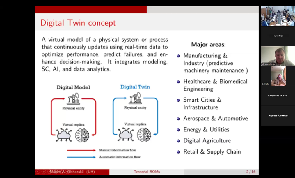
M.A. Olshansky and N.E. Gorfinkel (University of Houston, USA)
Presentation: “Tensor ROMs and Digital Twins in Geophysics”
The researchers presented technologies for reservoir flow modeling and drilling operation management based on digital twins. Methods for simulating production scenarios that enhance efficiency and safety in the oil and gas sector were discussed.
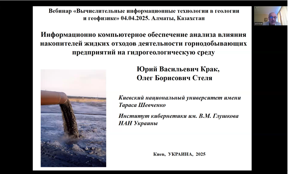
Y.V. Krak and O.B. Stelya (Kyiv National University, V.M. Glushkov Institute of Cybernetics)
Presentation: Mathematical modeling of groundwater filtration
The authors proposed a two-dimensional numerical model of pollution spread from liquid waste storage facilities. Database interface elements, hydrogeological calculations, and visualization of results accounting for both saturated and unsaturated zones were demonstrated.
A.N. and I.N. Bubnyak (Lviv Polytechnic National University)
Presentation: Digitization of geological maps in the digital era
The stages of transition from paper media to digital formats were examined in detail—from scanning and georeferencing to the creation of vector maps and metadata. Special attention was paid to the use of GNSS, drones, and mobile GIS applications to support fieldwork.
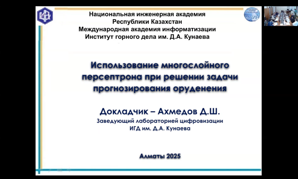
D.Sh. Akhmedov – AI in Forecasting Copper Mineralization
A multilayer perceptron model trained on geochemical data from the Zhezkazgan region was presented. The results demonstrated high prediction accuracy, allowing for the minimization of fieldwork and effective scaling of approaches using parallel computing.
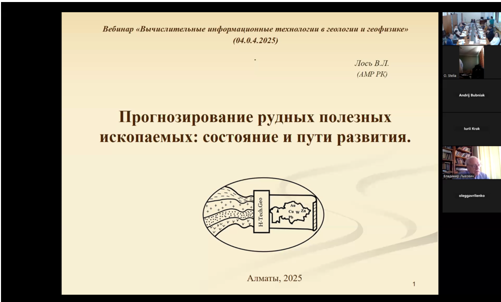
V.L. Los – Digital Technologies and Quantitative Ore Forecasting
The presentation focused on the ELAN software package—an instrument for multimodel analysis of geochemical data. The author presented examples of forecast maps based on ore body density and emphasized the importance of digitizing geological archives.

I am confident that the webinar will become an effective platform for exchanging advanced experience and strengthening international scientific cooperation.
Academician B.T. Zhumagulov
Related Posts
SCIENTIFIC WEBINAR NEWS